


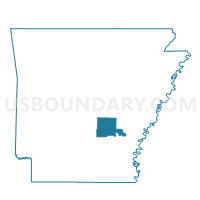
67 Voting District, Jefferson County, Arkansas
About
Outline

Summary
| Unique Area Identifier | 526866 |
| Name | 67 Voting District |
| County | Jefferson County |
| State | Arkansas |
| Area (square miles) | 18.14 |
| Land Area (square miles) | 17.97 |
| Water Area (square miles) | 0.17 |
| % of Land Area | 99.04 |
| % of Water Area | 0.96 |
| Latitude of the Internal Point | 34.34191190 |
| Longtitude of the Internal Point | -91.94406680 |
Maps


Graphs
Select a template below for downloading or customizing gragh for 67 Voting District, Jefferson County, Arkansas


Neighbors
Neighoring Voting District (by Name) Neighboring Voting District on the Map
- 26 Pastorla Voting District, Jefferson County, AR
- 28 (Plum Bayou) Voting District, Jefferson County, AR
- 651 Voting District, Jefferson County, AR
- 86 Voting District, Jefferson County, AR
- 87 Voting District, Jefferson County, AR
- P15 (Dudley Lake) Voting District, Jefferson County, AR
Top 10 Neighboring County Subdivision (by Population) Neighboring County Subdivision on the Map
- Dudley Lake township, Jefferson County, AR (1,821)
- Plum Bayou township, Jefferson County, AR (1,481)
- Pastoria township, Jefferson County, AR (168)